News ·
The cutting-edge farming tech improving Great Barrier Reef water quality
A unique combination of artificial intelligence, robotics, cloud-based computing and nature-based solutions are driving better outcomes for farmers and the Reef.
When you think of farming, you’re probably more likely to imagine rusty tractors than artificial intelligence, but the agricultural industry in Queensland is no technological slouch. Innovative approaches to farming and land management are helping farmers get the most out of their land and provide a much-needed lifeline to the Great Barrier Reef.
How are the Reef and farming practices connected? Many of the pollutants found on the Reef typically start their journey on agricultural land in regional Queensland. When it rains, they wash into rivers and streams that flow out to the Reef.
With our partners, we’re working with Queensland farmers and graziers to develop, implement and improve cutting-edge technologies that prevent these pollutants from reaching the Reef.
Here are five of the 22 innovative projects we’re funding:
1. Reducing herbicide use with AI and robotics
Most sugarcane growers only use pesticides and herbicides to control weeds as a last resort, but when weeds do take hold the conventional method for controlling them is blanket spraying entire fields. This method uses more herbicide than is necessary and the excess gets flushed out to waterways and onto the Reef, where it’s toxic to some organisms including seagrasses.
We’ve teamed up with James Cook University, Sugar Research Australia and Townsville-based tech company AutoWeed to design a smart weed management system that uses artificial intelligence robots to detect and spray weeds while avoiding crops. The robot can be retrofitted to any tractor and its accuracy is an impressive 95%. The technology aims to reduce the amount of toxic herbicides flowing into waterways by up to 80%.
A tractor fitted with AutoWeed's robotic sprayer. Credit: Sugar Research Australia and AutoWeed
2. Removing pollutants with seaweed biofilters
Once pollutants have entered the Reef, it can be difficult and costly to remove them. An innovative new solution is being developed that uses native seaweed species as biofilters, controlling pollution by capturing and breaking down carbon, nitrogen and phosphorous.
Our partner, the Australian Seaweed Institute, is currently testing small seaweed “bio-pods” and monitoring how much nitrogen they absorb. Researchers will then model how the biofilters are likely to perform in various locations across the Reef. This nature-based solution has already been recognised by the World Economic Forum as one of the top global innovations for protecting oceans.
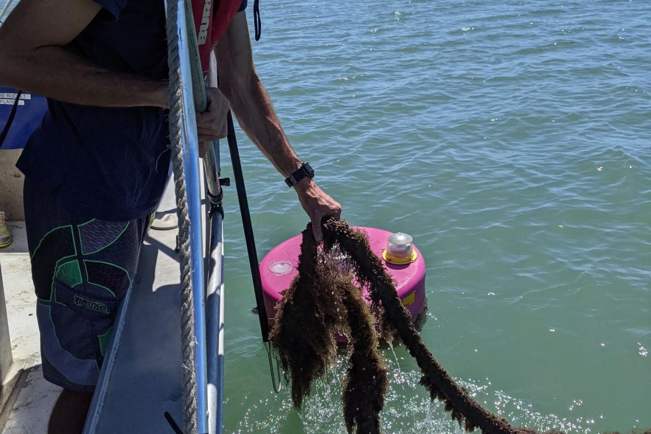
Sargassum is a native seaweed species being trialled in bio-pods. Credit: Australian Seaweed Institute
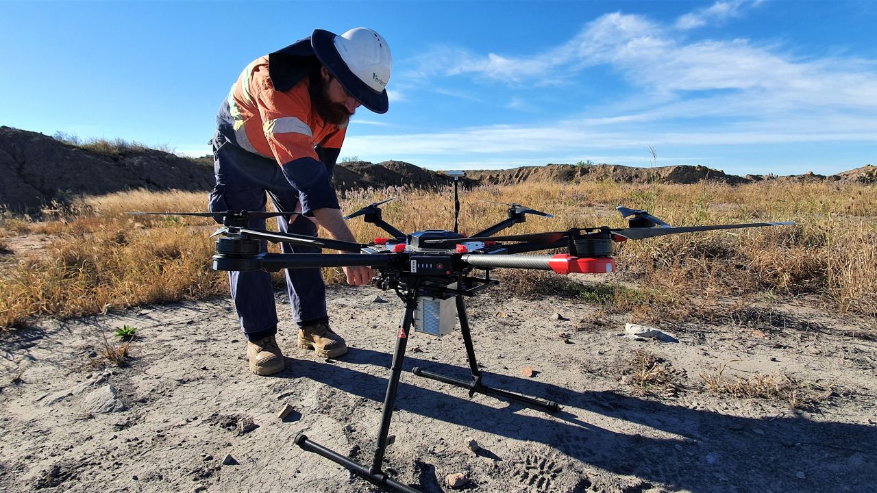
3. Restoring gullies and riverbanks with drones
Remediating degraded land, boosting native plant species and controlling invasive weeds along riverbanks and in wetlands is critical to improving habitat for local wildlife and water quality on the Reef. Site access can limit this work however due to remote locations, boggy terrain and safety issues such as crocodiles.
Many of our partners use drones to help them access sites and obtain data that would otherwise be difficult to get. When improving landscapes, a bird's eye view can be very handy.
Verterra Ecological Engineering uses drones mounted with LiDAR lasers that scan the landscape and ensure plans to remediate the worst affected areas are effective and efficient.
Another partner, Greening Australia, is trialling the use of drones to control weeds and disperse native seeds over large areas. It's comparing how effective this is with the results from manual efforts to identify areas that are better served by drones, and vice versa.
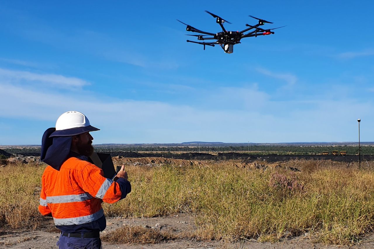
LiDAR-equipped drones feed information back about the surrounding landscape. Credit (and top image): Verterra Ecological Engineering
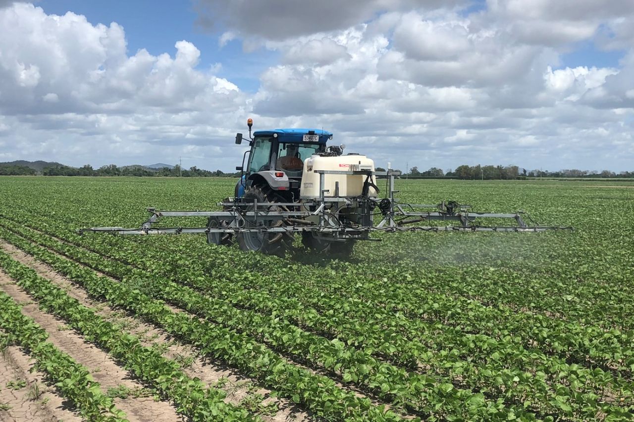
4. Reducing pesticide use with UV fluorescent dye
Sometimes it takes a striking visual to understand the ecological impact of our actions. That's why our partner, Farmacist, has been using UV fluorescent dye to demonstrate pesticide application methods at their trial paddocks.
The UV dye is mixed with water and applied through various nozzles on a spray boom to demonstrate the coverage and penetration of pesticides. Understanding coverage is critical because it allows landholders to confidently reduce their pesticide use without compromising on the results. And lower pesticide use means less will make its way to the Reef.
The UV dye demonstrations also show how far pesticides can drift in poor spraying conditions or with inappropriate equipment. With this knowledge, landholders can take action to reduce the risk of spray drift so pesticides stay in the paddock.
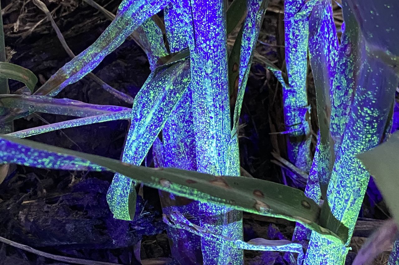
UV fluorescent dye applied on sugarcane to showcase droplet coverage from different nozzle configurations. Credit: Farmacist
5. Developing software for precision agriculture
The Australian banana industry operates predominantly on the tropical east coast with approximately 13,000 hectares under plantation producing more than 370,000 tonnes of bananas per annum. For banana growers, one of the most significant challenges to achieving precision agriculture is the difficulty in successfully identifying the spatial locations of banana yield variability within plantations. Yield map datasets will form the foundation for implementation of precision agriculture solutions in bananas.
We have teamed up with Farmacist to develop prototype bagging units with GPS and RFID scanning capability, electronic scales, and new weight station software. RFID tags are deployed across paddocks during banana bagging operations. These bunches, once harvested, come through the packing shed where they are weighed. Weights are recorded in the software and assigned to the RFID tag which has the locational data of the bunch. Yield maps are generated once bunches in the paddock have been harvested. Yield maps are available to banana growers on Farmacist’s new grower web interface. This interface also allows growers to monitor the location of their bagging machines in the field, track the number of deployed tags, and interrogate their yield maps.


