Eastern Cape York Water Quality Program
The Eastern Cape York water quality community will receive more than $8.5 million through the Reef Trust Partnership’s Eastern Cape York Water Quality Program (ECY WQP). The program will enhance knowledge of water quality and related ecosystem health in the region and reduce sediment loads caused by erosion from unsealed roads, informal tracks, gullies and uncontrolled bushfires.
#The program
The Eastern Cape York Water Quality Program is the culmination and expansion of the efforts of a community long committed to improving the health of the land and the Reef adjacent to the coast of Cape York.
Capacity building for local community-based organisations, active leadership and engagement in projects from Traditional Owners in the region and strong community consultation have been the cornerstones of developing this program. The program and all its projects are managed collaboratively by local organisations and Traditional Owners, whose country-specific activities are an integral component. Long operating as an informal network entrenched in the community, the Cape York Water Partnership member organisations used this program as a catalyst to formalise their governance arrangements and in doing so, demonstrate their capability and capacity to transition from a network to a capable program management organisation.
This program is a unique opportunity to proactively manage pressure on the Great Barrier Reef caused by increasing pollutant loads from unmanaged past development sites as well as ongoing incremental development in the region. The Great Barrier Reef closely hugs the coastline of Cape York, making the Reef more vulnerable to changes in land management that increase pollutant loads, particularly sediment. While the region’s catchments are considered ‘less disturbed’ compared to other GBR catchments, poorly managed roads, tracks and fires continue to pose a serious risk to the adjacent reef. Preventative interventions that cost far less than what is required in ‘highly disturbed’ catchments can preserve and restore the catchment, bringing incalculable benefits for the Reef for generations.
#Eastern Cape York catchments
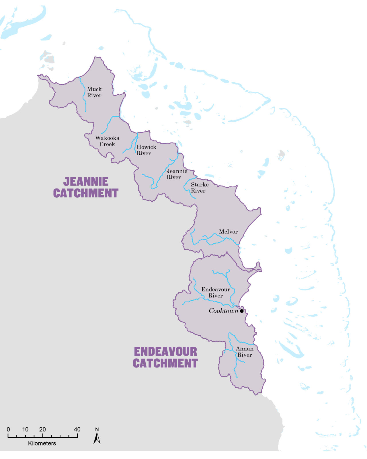

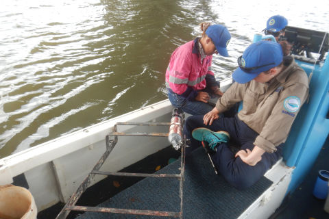
Eastern Cape York Water Quality Program: A4 Program Flyer
RTP- Water Quality
#Projects
Integrated WQ Monitoring
Cape York Water Partnership Inc.
$1.1M
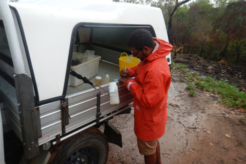
This important project will collect data from eastern Cape York rivers for which there is very little existing information. This data will help define baseline conditions, and establish local water quality improvement objectives, assess and quantify potential water quality impacts, and calculate sediment loads delivered to the reef. This integrated water quality and aquatic habitat monitoring project has a strong focus on the Annan catchment, but will also collect data in catchments from the Endeavour River up to Muck River. The project will also assess the condition of critical coastal wetlands and seagrass meadows. Importantly, wherever possible, Traditional Owners will be fully engaged and involved in monitoring on their country. 111
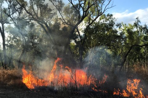
Integrated Fire Management for Eastern Cape York
South Cape York Catchments Inc.
$595,731
Late dry season wildfire events leave bare earth exposed and vulnerable to erosion when the wet season arrives, which can have substantial implications for water quality in rivers which flow out to the reef. This project aims to increase ground cover across 65,000 ha in the Jeannie, Starcke, McIvor, and Annan River Catchments, through:
- coordinating fire planning and management across multiple property boundaries
- conducting early burns across up to 30% of the proposed project areas, subject to Traditional Owner and Landholder aspirations.
- working with Traditional Owners, freehold landowners and leaseholders to increase capacity to undertake fire management activities
- preventing the spread of late season/high intensity wildfires by implementing burnt fire breaks
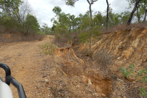
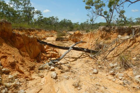
Erosion Control on Primitive Roads and Tracks
Cape York Water Partnership Inc.
$1.084M
The objective of this project is to map and assess erosion along primitive roads, tracks and fence lines over whole of program area and to control erosion at pilot demonstration sites. Best Management Practices (BMPs) for primitive road and track maintenance to reduce erosion will be developed in collaboration with local landowners and land managers. Key activities include:
- Map and assess erosion along primitive tracks in program area, identify management priority sites
- Control erosion at pilot sites
- Develop Best Management Practices (BMPs) for control of erosion from primitive tracks
- Educate land managers on application of BMPs.
Gully Erosion Control
South Cape York Catchment Inc.
$2.155M
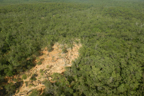
Gully erosion from past developments, over grazing, land management practices and poorly directed road runoff in the program area contributes large amounts of sediment to the GBR lagoon. The objective of this project is to control gully erosion in the highest priority gullies in the Annan River catchment – specifically at identified and accessible hotspots in the Oaky, Scrubby and Esk sub-catchments. The goal is to reduce anthropogenic fine sediment loads from Gully erosion, contributing to the ‘Reef 2050 Water Quality Improvement Plan 2017-2022’ 10% anthropogenic sediment load reduction target for the Annan River.
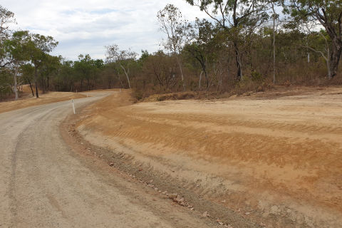
Erosion Control on Council Roads
South Cape York Catchments Inc.
$1.4M
This project aims to develop and demonstrate practical and implementable best management practices (BMPs) for road construction and maintenance for the reduction of soil erosion along unsealed Council roads. Pilot projects will demonstrate the costs and benefits of different road maintenance practices that reduce sediment run-off to the GBR while still meeting road use standards.
This project is a partnership with Cook Shire Council (CSC). The pilot sites will be located on CSC road segments on the Oaky Creek Road in the Annan Catchment. The sites have been selected because they are known to be chronic sources of fine sediment delivered to the Great Barrier Reef Lagoon.
Fire management and Primitive Road Erosion Control
South Endeavour Pty Ltd
$400,000
The project will occur over 46,000 ha of South Endeavour Trust owned land on Caloola, Alkoomie, South Endeavour and Kings Plains Stations. Approximately 38,000 ha of the project area is in the Annan catchment, comprising 38% of the entire catchment. The remaining 8000 ha is in the Endeavour catchment. The project area accounts for over 70% of the sub-catchments of Oakey Creek and Scrubby Creek, the highest fine sediment sources to the reef in the Annan catchment.
The objective of the project is to tackle all significant sources of sediment on the project area through control of erosion on tracks and associated gullies, and fire management to reduce late dry season burning of the project area, thereby reducing the amount of bare ground at the start of the wet season.
Traditional Fire and Land Management
Yuku Baja Muliku Landowner & Reserves Ltd
$1.04M
This project is entirely on Yuku Baja Muliku (YBM) owned lands with a focus on the Annan River and its estuary as well as the mangrove lined coastline that runs through their traditional estates, including Grave Point, Archer Point, Spring Creek, Walker Point, and the southern part of Walker Bay.
YBM Rangers will be at the forefront of the program, supported by elders (as key knowledge holders) at key points of the project. The project will map, assess and control erosion along roads, tracks, fire breaks, fence lines.
Erosion control pilot projects will include known road/track segments where sediment is delivered directly to local fringing reefs. A main track and fire break through the CYPAL National Park land will also be targeted for erosion control with whoaboys and gully control.